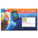
TN Complete is the flight analysis software for the GPS flight instruments.
Current Version 2.8.1
Software developed exclusively for the Aircotec integrated GPS instrument range. Extensive cooperation between the hard- and software developers means full integration/support!
Basic functions
TN Complete shows the route flown, the barogram of the flight (including vario and TAS [1]), it gives the flight stats and a temperature curve for the flight. All these parameters may be displayed simultaneously In order to give the full overview in one single screen.
Flights may be displayed in Google Earth in 3D, and there are a number of extra functions aside from the standard GE ones.
An integrated memory stores logbook data, waypoints, routes, thermals (Top Navigator) plus the calibration of grid patterns (?). All entries have a “comments” field for user comments.
TN Complete makes the interaction between the instrument and the PC easier. Up- and downloads of flights, turnpoints, routes, thermals, airspace; all is easier with TN Complete.
Optimising and uploading of flights to the Online Contest (OLC) is done in a few easy steps.
Maps for viewing the flights on the computer screen are available for free on the Internet. The maps have a resolution of 14m/pixel. Map downloading is easy.
TN Complete is never finished! We continually update it and updates are always free!